|
|
Newhall Land Report on St. Francis Flood Damage

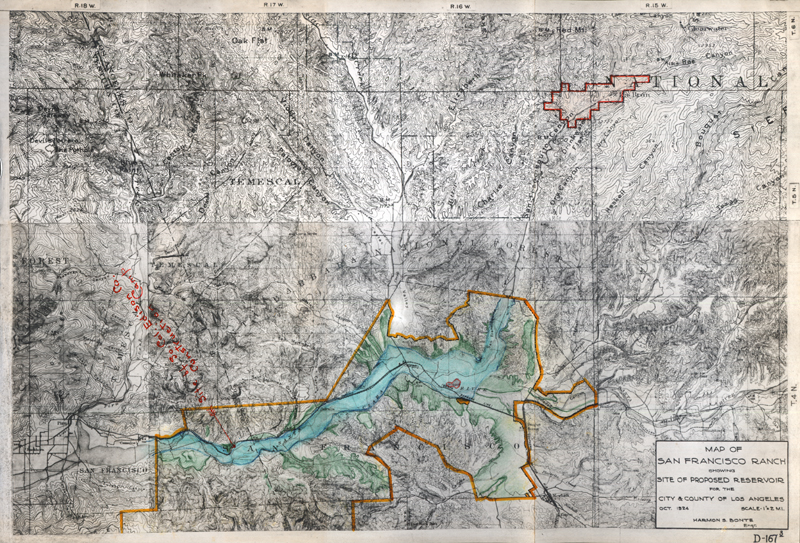
Click image to enlarge | [Download 60MB Version] (Original) map showing The Newhall Land and Farming's Co.'s property and the St. Francis Dam and reservoir site, from Newhall Land's "Report on St. Francis Dam Flood" dated March 24, 1928. Newhall Land's property is hand-colored by Almer M. Newhall, who completed the report (Almer was assistant to the president, George A. Newhall Jr.). The site of the Edison camp at Kemp, where 84 of the ~150 linemen died when the floodwaters hit on March 13, 1928, is noted in red. The underlying map dates from October 1924 and is titled, "Map of San Francisco Ranch Showing Site of Proposed Reservoir for the City & County of Los Angeles" [sic; the dam and reservoir were City of L.A.-only]. Harmon S. Bonte, engineer. Here, the dam and reservoir area is outlined (by the Newhalls) in red at upper right. This map measures 11x16 inches and has a waxy finish as if coated to protect the colorizing, which appears to be executed in colored pencil or wax pencil.
NL2834: 19200 dpi jpeg from original map in the stated report. |
The site owner makes no assertions as to ownership of any original copyrights to digitized images. However, these images are intended for Personal or Research use only. Any other kind of use, including but not limited to commercial or scholarly publication in any medium or format, public exhibition, or use online or in a web site, may be subject to additional restrictions including but not limited to the copyrights held by parties other than the site owner. USERS ARE SOLELY RESPONSIBLE for determining the existence of such rights and for obtaining any permissions and/or paying associated fees necessary for the proposed use.
